
|
|
The McBoiko's Land |
| the land | the yurt | the critters | photo album | the methow |
| overview | property boundaries | satellite image | visual tour | how to get there |
|
The land is very rugged and remote. We are at the end of a dead-end dirt road. Until just recently, there were no roadsigns and my directions used markers like "little yellow Quail Crossing sign" and a neighbor's "Slow: old deaf dog crossing" sign. I liked it better that way. Once, a friend trying to find the place the first time, got within 500 yards of the yurt and backed down the drive thinking she'd made a mistake because the grasses were so high, she couldn't tell if she was still on a road. When we first looked at the land with our kids, they didn't know what to make of the place and opted for a "safer" spot to play - the roof of the car! From the yurt, there are practically no visible signs of other people. We see only part of one neighbor's roof and way off in the distance, on the hills across the valley, a few lights flicker at night. The weather can be harsh and extreme. The summers are hot (90s and 100s) and dry; the winters are cold and snowy. There are dramatic storms where the thunder reverberates off the mountains and literally shakes the ground. There's an intensity here that's lacking in Seattle. The wind blows harder; the rain comes down in buckets. It's a harsh and demanding environment but beautiful. We have a lot of elevation change so there are several varied ecosystems: dry areas with rocky outcroppings where only the hardiest plants can survive, wooded groves at lower elevations and a wet-lands abundant with plants and animals by Alder Creek. At night, the smell of sage is overpowering and the sky is ablaze with stars. |
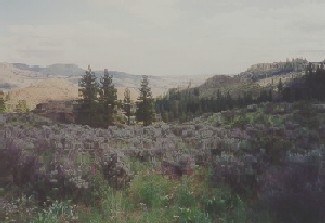 View looking south towards Golden Doe Ranch. 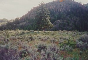 View looking west at Doe Haven. 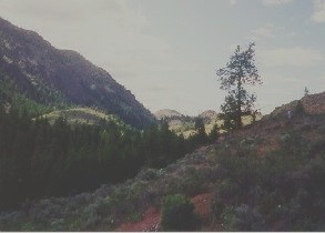 View looking north up the valley. |
|
back to the top |
return to previous page |
click to continue |
|
|
|
|||